See what to expect on the screen while flying your drone!
 Once the Mission has begun, the interface will change to our inflight map. You’ll notice the interface is like Mission Planning, however, has adapted parts of the screen for more useful data during a flight. Here is more detail:
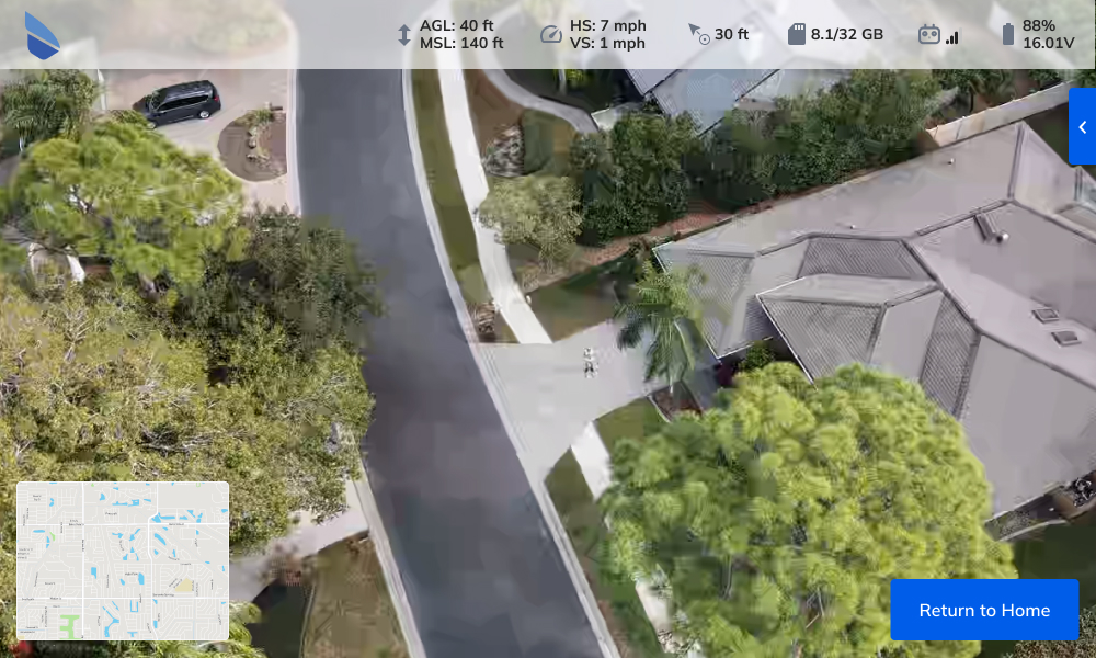
- On the bottom left-hand side of the screen, you’ll see there is a Picture-in-Picture with a livestream of video from the drone.
-
- If you would like to swap the video to take over most of the screen, press anywhere inside the picture-in-picture and it will swap the main view. You can swap back by pressing the minimap at any time.
- The top of the screen will now display the Flight Telemetry bar.
-
- Flight Altitude is displayed in both AGL (Above Ground Level) altitude and MSL (Mean Sea Level) altitude. These are both displaying the altitude of the drone, not the home location. NOTE: If the drone is flown while in offline mode, the user will only see an altitude value that represents the height above the home location.
- Speed is displayed with two values, HS for Horizontal Speed and VS for Vertical Speed.
-
- Distance from Home is displayed to the user to show how far the drone is from the original take-off location.
- SD Card Storage is shown with a number of how many GB of data are used out of the total amount of storage on the device. (ie: 6/24)
- Controller Signal Strength is displayed with how well the controller has connectivity with the drone. If signal strength is low, we recommend NOT to continue the Mission, as it may interfere with drone accuracy and safety. If the signal strength gets low enough, the application will automatically warn you.
- Drone Battery Life is displayed as the last value on the telemetry bar.
- The Flight Parameters window is set to dock to the right-hand side of the screen by default but can be undocked by pressing the blue arrow at any time to view the parameters the Mission was configured for. Note: These values are greyed out and unable to be edited during the flight.
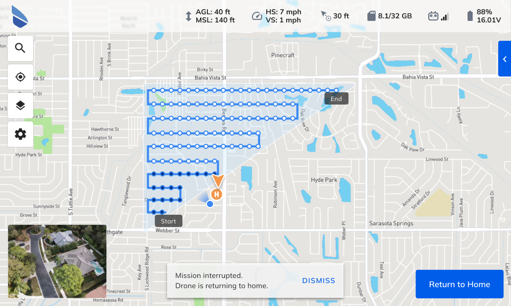
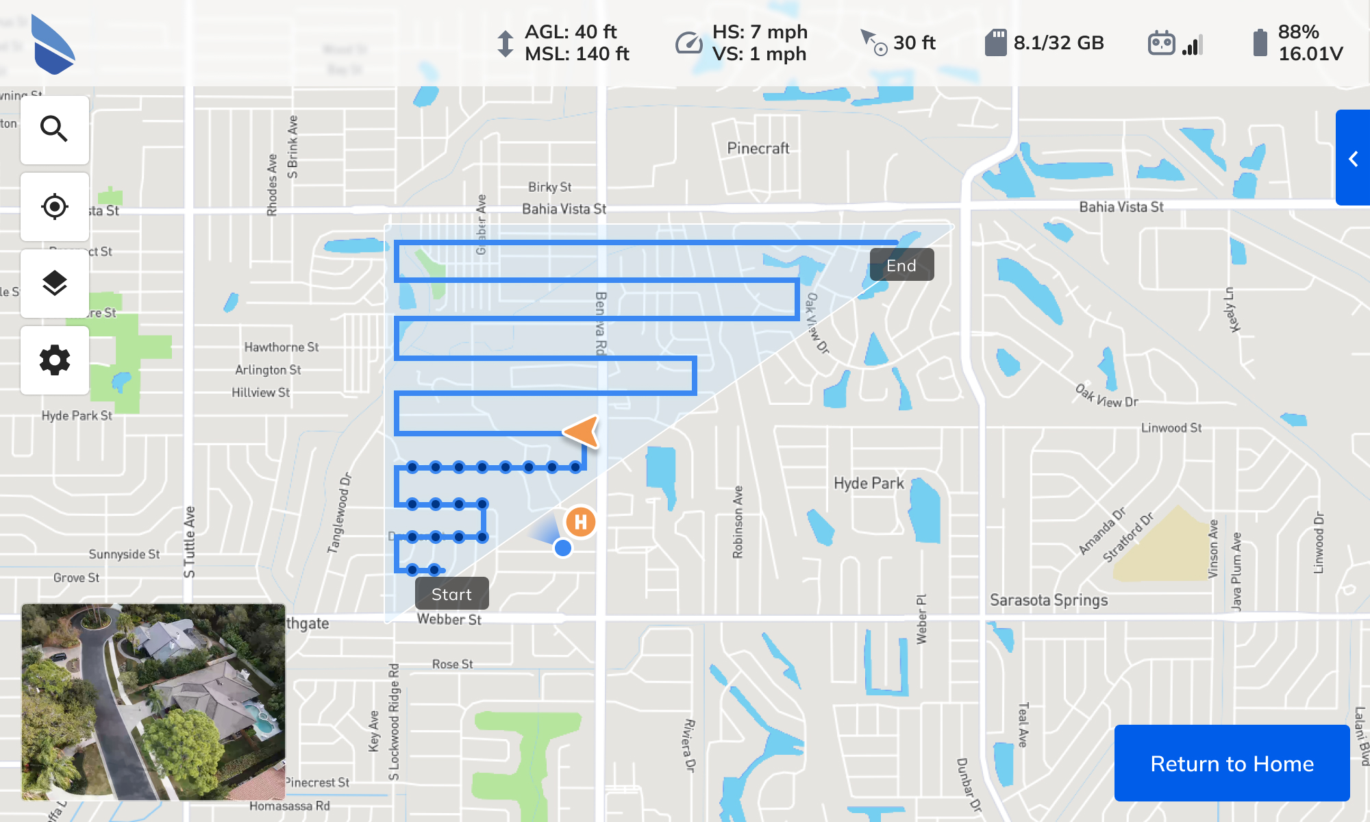
- Drone Location is displayed on the map with an orange arrow. This icon will move as the drone progresses through the Mission.
- Image Locations will be displayed on the map with black dots along the flight path, where images have been captured by the drone.
- Tablet Location (aka You are Here) is displayed on the map with a blue dot and a radial shadow which displays the direction the tablet is pointing.
- Pause allows you to immediately stop the drone at any time. Additionally, once the drone is paused, you can take control of the drone using the controller to make any maneuvers you would like. Once you are ready to continue the Mission, press the Resume button and the drone will return to the original Mission.
- Return to Home will stop the Mission and return the drone to the home location. Note: You’ll be prompted to confirm before the drone will stop and return home.
While in flight, you can see the progress of the drone and image capture locations in the map:
If the mission is interrupted, you'll receive a warning and see the images that were not captured: