Summary of updates found in the Mapware release dated 9/1/2022
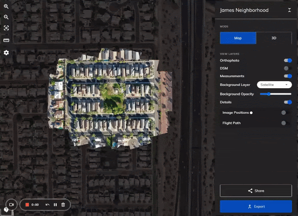
The Map - Multiple Model Support
- Single Map instance for all models in a project
- Layers grouped logically by model
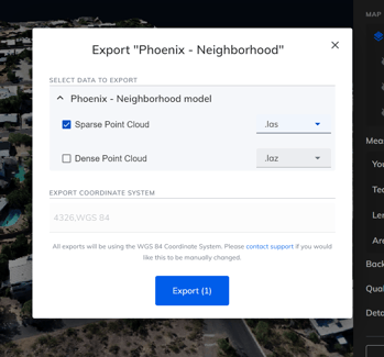
- Exports have been updated to allow selection of layers to be exported, with proper file types available and grouped by model on the export tab
-
- Ability to import las/laz files directly from the Map (plus icon next to 'Map Data')
- Ability to process models directly from the Map (plus icon next to 'Map Data')
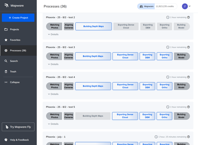
Processing Tracker
- New Processing page available on the navigation bar that allows users to better view progress of their models during processing across all projects
- New Processing tab for each project, which allows users to view processing updates specific to that project
- Remaining time estimation provided for all models during processing
Export Updates
- Point clouds generated by Mapware are now able to be exported in .las, .txt, .e57, .tiff, and .pcd format (in addition to previously available .laz, .ply)
- Ability to export data from the model list
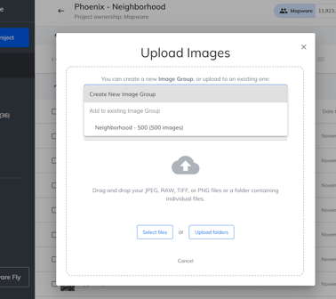
Upload Images via Batch
- Ability to create image groups for improved organization of images
- Ability to upload images to an existing image group
- Ability to select a single folder and automatically upload images inside a folder
Mapware Fly Notification
- Added popup when logging into Mapware to view more information and download Mapware Fly (our flight planning and control application available now for Android)
- Popup is accessible at any time by clicking the Mapware Fly button on the navigation bar

In case you missed it - released last time!
- Ability to view image positions and flight path of the drone for the model
- Ability to toggle background layers for 2D Map (Street, Satellite, Terrain, Dark)
- Ability to change background layer opacity for 2D Map