Summary of updates found in the Mapware release dated 5/25/2023
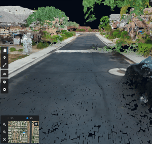
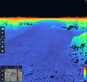
Elevation View
- Users can now view the elevation of point cloud data by pressing the "Elevation View"
 button on the toolbar, which will show a color gradient that depicts the relative elevation of each point in the data.
 - Users can focus on subtler elevation differences, such as road imperfections, by adjusting the gradient to only colorize specified elevation ranges. This is done by adjusting the min and max values using sliders on the elevation legend.
- The elevation legend will automatically update when the user changes between units of measurement.
KML/KMZ Import
- Users can now import vector, point, and polygon data in .kml and .kmz format to view alongside other layers in the Map.
LAS/LAZ Import
- Users can now create richer digital twins by importing LiDAR point cloud data in .las or .laz format into Mapware to view it alongside other layers in the Map.
Additional Enhancements and Bug Fixes
- Interface updates inside of a project:
- "Models" tab has been renamed to "Map Layer(s)"
- "Data & Files" tab has been renamed to "Files"
- "Images" tab has been renamed to "Image Group(s)"
- Bug fixed where during processing some layers that were available to the user and presented the status of "active" when the map layers were not yet ready.
- Bug fixed with the forgot password screen - it will now function as expected and notify the user if the email is invalid.
- Exports are not available for analysis layers and imported models. If attempted, a message will display informing the user.
- Some bugs with the mobile UI have been resolved to provide a better mobile experience for users.
- With an annotation selected, pressing delete on the keyboard will now delete the annotation.