Mapware enables terrain following during flight to improve data capture in a region with variable elevations.
Mapware Fly offers a Terrain Following setting, which, when activated, will maintain the drone's altitude above the ground (AGL) despite changes in terrain elevation. Leaving this setting off, will cause the drone to have a straight mean sea level altitude (MSL) even if the altitude above the ground changes.
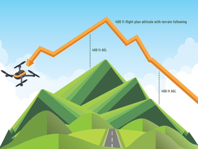
We recommend always turning it on. Doing so can improve the quality of your images (helping prevent blurriness or undersampling) and prevent you from exceeding the FAA’s maximum altitude limit when you fly over a dip in the terrain.
Additionally, there is an option to save terrain data to device. This setting allows the user to cache the terrain data if you are planning to fly without connectivity to the internet. It's recommended to NOT select this option if you are planning to have connectivity during your flight, as it will prevent a delay in performance while the device downloads the data.