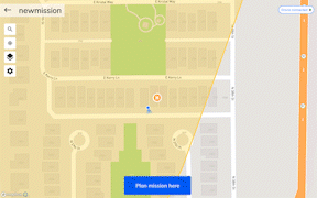
Mapware Fly allows you to create flight plans with a variety of different mission types in order to capture the optimal images for your specific goals.
Mission Types
Grid Mission: This is the default mission type and is ideal for quick and accurate image capture. This mission type would be recommended for generating quick 2D maps or capturing large and flat terrain (such as a field). Generally -90 degree or NADIR camera angle is ideal for this mission type.
Double Grid Mission: Sometimes known as a crosshatch pattern, this is ideal for optimal 3D model creation. Capturing areas in 2 different directions will enhance the vertical details captured in order to generate improved point clouds and meshes for 3D models. Keep in mind that this mission type will take significantly longer and capture double the images of a normal grid mission. We recommend a -70 degree camera angle with a double grid mission for optimal 3D models.
Corridor Mission: Ideal for linear areas to be captured, such as utilities (such as pipelines, powerlines, canals, etc). This mission type allows a similar image capture to a grid mission however captures back and forth specifically to linear (long and narrow) shapes with bends. This mission type has an additional parameter to adjust the corridor width, allowing you to modify how wide you want the corridor to be captured.
Orbit Mission: This is an advanced mission type for users looking to focus on a specific object, building, or landscape. An orbit will allow you to capture a number of images specific to that location and can be a great addition to fly after a normal grid mission to improve 3D models. This mission type has an additional parameter which allows the configuration of the overlap using the angle between images. Setting a closer angle will have more overlap and capture more images than setting the angle wider.
Free Flight Mission: The least used mission type allows more flexibility to you in order to capture areas exactly to your liking. Both the flight path of the drone and the images captured, are manually controlled via the drone controller by you. This mission type has an additional parameter for turning on automatic image capture. When this feature is activated, the camera will automatically take pictures to the configured distance or time set in the parameters window. This is designed so the pilot can focus on flying the route and know images will be automatically captured at set intervals. Note: When you select this mission type, it will remove any previously created area of interest on the map.